

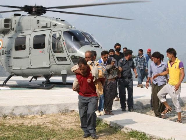
On 5 October 2025, amid incessant rain and flooding along the Torsa, Indian Army Aviation launched a swift rescue near Bhutan’s Phuentsholing after a request from Royal Bhutan Army. Two helicopters from the Sevoke Road Aviation Base reached around 12:55 p.m., airlifted three civilians, and returned despite marginal weather and poor visibility.
The Story
A low-pressure system over the Bay of Bengal intensified rainfall over the sub-Himalayan belt through the weekend, pushing the Torsa above danger levels and inundating stretches in North Bengal and southern Bhutan. Local authorities reported stranded workers from Rigsar Construction Pvt. Ltd. in the Phuentsholing area. With visibility too poor for Druk Air assets to fly from Paro, the Royal Bhutan Army escalated a request to India under established emergency coordination channels.
Public Relations Officer (Defence) said two Army helicopters launched from Sevoke Road, conducted aerial reconnaissance to identify safe landing zones in rugged terrain, and executed an evacuation under deteriorating conditions. Three of the four stranded personnel were airlifted to safety; search and coordination for the remaining individual continued with Bhutanese agencies on the ground. A senior Indian military official said the mission reflects a standing commitment to humanitarian operations and the “enduring friendship” with Bhutan.
The sortie profile, officials added, involved low-level approaches to avoid cloud build-ups along the foothill ridges, coupled with short ground times to minimise exposure. Back in North Bengal, civil agencies monitored river levels as the rain bands shifted, with advisories for embankment watch, restricted movement across vulnerable road sections, and caution around inundated low-lying areas.
Why It Matters
Rapid, weather-denied rescues test regional preparedness across borders. The mission demonstrates interoperable protocols between India and Bhutan for humanitarian assistance and disaster relief (HADR), the capacity of Army Aviation to operate in constrained valleys during monsoon bursts, and the importance of forward-based assets near the Siliguri corridor for swift response to transboundary river hazards.
Background / Context
• Geography: The Torsa (Amo Chhu in Bhutan) rises in the eastern Himalaya and flows south through Bhutan into West Bengal, creating quick-rise flood risks when cloudbursts or monsoon lows stall over the foothills.
• Weather trigger: Bay of Bengal low-pressure systems commonly drive heavy rain bands toward the sub-Himalayan West Bengal–Bhutan arc in October, when soils are saturated and landslide risk is elevated.
• HADR framework: India and Bhutan coordinate closely through defence and disaster-management channels for search-and-rescue, medical evacuations, and logistics support. Forward air bases in North Bengal enable rapid launches into the Bhutan foothills when requested.
• Operational constraints: Mountain flying in marginal conditions requires terrain familiarity, short-field landing capability, and close air–ground coordination to avoid downdrafts, obscuration, and shifting riverine obstacles.
Implications
For India–Bhutan cooperation, the episode reinforces trust in mutual aid during extreme-weather emergencies and validates standard operating procedures for quick tasking and deconfliction of airspace. For regional disaster management, it highlights the need to pre-position relief material along transboundary rivers during the post-monsoon window and to map safe heli-landing sites in advance. For local communities and contractors, the incident underlines the importance of weather-ready SOPs—headcounts, communications, and designated high-ground muster points—to reduce time-to-rescue.
Conclusion
As rainfall eases and river levels stabilise, attention will shift from high-risk evacuations to damage assessment and road restoration. The Phuentsholing airlift shows how proximity, protocol, and pilotage converge to save lives when minutes matter—an essential playbook as extreme rain events keep testing the Himalayan foothills.