

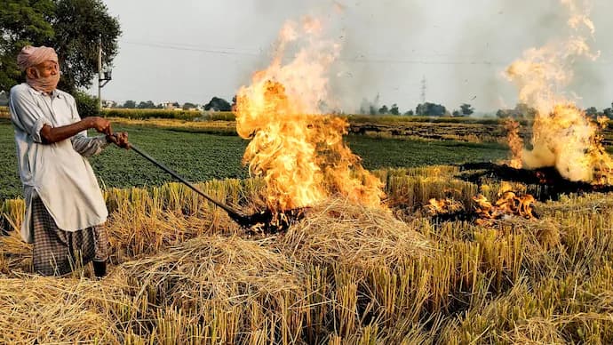
Punjab recorded nearly 70% fewer farm fire incidents in 2024 compared to 2023, according to satellite data from the Punjab Remote Sensing Centre (PRSC). Yet, the total area scorched by stubble burning slightly increased, casting doubt on the reported decline and pointing to possible gaps in satellite detection and reporting.
The Story
Satellite aggregation data from PRSC and the Punjab Pollution Control Board (PPCB) showed 10,909 farm fire incidents in 2024 against 36,663 in 2023 — a major statistical improvement. However, the area under residue burning for paddy rose marginally from 19.14 lakh hectares in 2023 to 19.17 lakh hectares in 2024.
The report titled “Comparison of district-wise area classified under residue burning (paddy) for year 2023 and 2024” covered the period between 15 September and 30 November.
While paddy sowing expanded from 30.02 lakh hectares in 2023 to 31 lakh hectares in 2024, experts argue that the rise in burnt area despite fewer reported fires signals a possible underestimation of incidents.
Officials suspect that some farmers may have burnt stubble outside satellite monitoring windows, which rely on thermal imaging at fixed times during morning and afternoon passes.
The least burnt area was reported from Pathankot, followed by Rupnagar, while Patiala and Sangrur recorded the largest burnt areas.
Why It Matters
Stubble burning remains one of north India’s most persistent environmental challenges, contributing to severe air pollution episodes across Punjab, Haryana, and Delhi every winter.
While the government has projected sharp progress through subsidies and awareness campaigns, the discrepancy between recorded incidents and actual burnt area raises questions over the credibility of emission data and the effectiveness of monitoring systems.
If under-reporting is widespread, it could undermine the basis for policy planning, crop residue management, and environmental compliance under the National Clean Air Programme.
Background / Context
-
Satellite Monitoring: Farm fires are tracked via thermal imaging by satellites at fixed time intervals each day. Burnt area, however, is aggregated weekly, which may overlook quick burns.
-
Policy Efforts: The State and Central governments promote crop residue management machines such as Happy Seeders, Super Straw Management Systems, and Smart Seeders, with financial incentives for farmers.
-
Environmental Impact: Stubble burning contributes up to 30–40% of particulate pollution in north India during peak months, according to CPCB estimates.
-
Legal Framework: Burning residue violates Section 19(5) of the Air (Prevention and Control of Pollution) Act, 1981, and is monitored under National Green Tribunal directives.
Expert Voices
A former PPCB official said that “if farm fires had genuinely fallen, burnt area should have dropped too,” adding that some farmers “may have timed burning to evade satellite detection.”
Gurvinder Singh, former Director, Punjab Agriculture Department, said the data gap suggests the technology needs updating to ensure real-time, high-frequency scans.
Jaskirat Singh, an environmental activist, added that “government claims of success are not matched on the ground. The rise in burnt area tells the real story.”
A PPCB officer, however, argued that “technical duplication” could also explain the anomaly, citing cases where multiple fires were recorded from the same field.
Implications
The discrepancy underscores the limitations of remote sensing as a standalone monitoring tool. Without reliable ground verification, policy decisions risk being based on incomplete data.
It also highlights the ongoing tension between data-driven policymaking and field-level realities, where farmers still prefer burning as a low-cost residue disposal method despite official bans and incentives.
Conclusion
Punjab’s 2024 farm fire data presents a paradox — fewer incidents but more burnt land. Whether this reflects a statistical glitch or a deeper governance gap, it shows that combating stubble burning requires not just technological surveillance but credible ground-level accountability and farmer engagement.